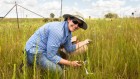
“Indonesia comprises more than 17,000 islands. Because so much of the country is surrounded by water, it’s important to pay attention to coastal areas. Many coastal cities, including Jakarta, are experiencing subsidence owing to geological processes and coastal dynamics. Rising sea levels, changing tides and flooding, resulting from climate change, are already causing suffering along the northern coast of Java.
I started studying the impacts of climate change on Indonesia’s coastal areas in 2005, as a PhD student at the Justus Liebig University Giessen, Germany. I’m continuing this work today as head of the Geospatial Information Agency of Indonesia.
My colleagues and I maintain 260 tide-gauge stations around the country, and plan to establish 32 more in 2024. These unstaffed stations provide real-time data every 5 seconds, and the information is used by various agencies and researchers to monitor sea-level rise, subsidence patterns, tsunamis, earthquakes and the impacts of climate change.
Before we can set up a tide-gauge station, we have to ensure that it is located at precise coordinates so that it matches the elevations of the other stations. In this photo, I am helping to set up a new gauge at the Muara Angke harbour in Jakarta by using a GPS tool on a tripod to measure the station’s coordinates. The tool allows me to get horizontal and vertical measurements at the millimetre scale.
I also use data from the tide gauges to create a reference map that is used by all the ministries and other agencies in Indonesia to develop their own maps. These maps will help to address future climate-change challenges in Indonesia by showing precise patterns of coastline measurements, marine resources, coastal settlements, erosion and flooding.”
 I started fossil hunting in my 60s — now I have more than 2,000 pieces
 Economists count the cost of ‘risky’ science
 How I learnt to write research papers as a non-native English speaker