Abstract
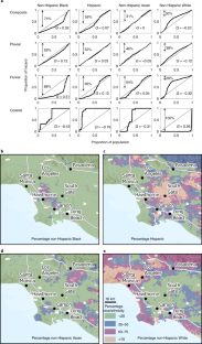
Flood risks in the United States have historically been underestimated, particularly with respect to human well-being and within low-wealth and marginalized communities. Here, we characterize a fuller range of risks in Los Angeles, California, using a quantitative framework that intersects flood hazards from rainfall, streamflow and storm tides with measures of exposure and vulnerability including ethnicity, race and socioeconomic disadvantage. We find that between 197,000 and 874,000 people (median 425,000) and between US$36 billion and US$108 billion in property (median US$56 billion) are exposed to flooding greater than 30 cm within the 100-year flood zone, risk levels far above federally defined floodplains and similar to the most damaging hurricanes in US history. These risks are disproportionately higher for non-Hispanic Black and disadvantaged populations, burdening communities that may have greater challenges recovering and reinforcing socioeconomic inequities. Our framework creates opportunities for transparently and equitably reducing flood risks in urban areas.
This is a preview of subscription content, access via your institution
Access options
Access Nature and 54 other Nature Portfolio journals
Get Nature+, our best-value online-access subscription
$29.99 / 30 days
cancel any time
Subscribe to this journal
Receive 12 digital issues and online access to articles
$119.00 per year
only $9.92 per issue
Buy this article
- Purchase on Springer Link
- Instant access to full article PDF
Prices may be subject to local taxes which are calculated during checkout


Data availability
The parcel-level dataset developed for this study is available through the Dryad and digital repository accessible at https://doi.org/10.7280/D1RH7Z.
Code availability
Codes used for exposure and equity analysis are available through the Zenodo digital repository accessible at https://doi.org/10.7280/D1RH7Z. Custom codes in Fortran, Matlab, Python and R used for data preparation, flood simulation and postprocessing are available upon written request from the authors.
References
Smith, A. B. U.S. Billion-dollar Weather and Climate Disasters, 1980–Present (NCEI, 2020); https://doi.org/10.25921/stkw-7w73
National Academies of Sciences, Engineering, and Medicine Framing the Challenge of Urban Flooding in the United States (National Academies Press, 2019).
Rainey, J. L., Brody, S. D., Galloway, G. E. & Highfield, W. E. Assessment of the growing threat of urban flooding: a case study of a national survey. Urban Water J. 18, 375–381 (2021).
Gall, M., Borden, K. A., Emrich, C. T. & Cutter, S. L. The unsustainable trend of natural hazard losses in the United States. Sustainability 3, 2157–2181 (2011).
Zhang, W., Villarini, G., Vecchi, G. A. & Smith, J. A. Urbanization exacerbated the rainfall and flooding caused by hurricane Harvey in Houston. Nature 563, 384–388 (2018).
Davenport, F. V., Burke, M. & Diffenbaugh, N. S. Contribution of historical precipitation change to US flood damages. Proc. Natl Acad. Sci. USA 118, e2017524118 (2021).
Hino, M. & Nance, E. Five ways to ensure flood-risk research helps the most vulnerable. Nature 595, 27–29 (2021).
Bullard, R. D. & Wright, B. The Wrong Complexion for Protection: How the Government Response to Disaster Endangers African American Communities (New York Univ. Press, 2012).
Chambliss, S. E. et al. Local- and regional-scale racial and ethnic disparities in air pollution determined by long-term mobile monitoring. Proc. Natl Acad. Sci. USA 118, e2109249118 (2021).
Chakraborty, J., Collins, T. W. & Grineski, S. E. Exploring the environmental justice implications of Hurricane Harvey flooding in Greater Houston, Texas. Am. J. Public Health 109, 244–250 (2019).
Siders, A. R. & Keenan, J. M. Variables shaping coastal adaptation decisions to armor, nourish, and retreat in North Carolina. Ocean Coast. Manag. 183, 105023 (2020).
Wing, O. E. J. et al. Inequitable patterns of US flood risk in the Anthropocene. Nat. Clim. Change 12, 156–162 (2022).
Finch, C., Emrich, C. T. & Cutter, S. L. Disaster disparities and differential recovery in New Orleans. Popul. Environ. 31, 179–202 (2010).
WMO Atlas of Mortality and Economic Losses from Weather, Climate and Water Extremes (1970–2019) (World Meteorological Organization, 2021).
Brakenridge, R. Global Active Archive of Large Flood Events, 1985–Present (Dartmouth Flood Observatory, 2021); https://floodobservatory.colorado.edu/Archives/index.html
Tate, E., Rahman, M. A., Emrich, C. T. & Sampson, C. C. Flood exposure and social vulnerability in the United States. Nat. Hazards 106, 435–457 (2021).
Porter, K. et al. Overview of the ARkStorm Scenario (USGS, 2011); https://pubs.usgs.gov/of/2010/1312/
Ralph, F. M., Dettinger, M. D., Cairns, M. M., Galarneau, T. J. & Eylander, J. Defining “atmospheric river”: how the glossary of meteorology helped resolve a debate. Bull. Am. Meteorol. Soc. 99, 837–839 (2018).
Jones, L. M. The Big Ones: How Natural Disasters have Shaped Us (and What we can do About Them) (Anchor Books, 2019).
Population Estimates for Los Angeles County for July 1, 2021 (U.S. Census Bureau, accessed 1 February 2022); https://www.census.gov/quickfacts/losangelescountycalifornia
Regional Data, GDP and Personal Income for Los Angeles, CA (U.S. Bureau of Economic Analysis, accessed 1 February 2022); https://apps.bea.gov/itable/iTable.cfm?ReqID=70&step=1&acrdn=5
Orsi, J. Hazardous Metropolis: Flooding and Urban Ecology in Los Angeles (Univ. of California Press, 2004).
Wing, O. E. J. et al. Validation of a 30 m resolution flood hazard model of the conterminous United States. Water Resour. Res. 53, 7968–7986 (2017).
Bates, P. D. et al. Combined modeling of US fluvial, pluvial, and coastal flood hazard under current and future climates. Water Res. 57, e2020WR028673 (2021).
Sheng, J. & Wilson, J. P. Watershed urbanization and changing flood behavior across the Los Angeles metropolitan region. Nat. Hazards 48, 41–57 (2009).
Hydraulics Report. Floodplain Analysis, Los Angeles River: Barham Boulevard to First Street. Flood Plain Management Services Special Study. Los Angeles, California (U.S. Army Corps of Engineers, 2016); https://eng2.lacity.org/projects/LARIVER_Glendale_Narrows/docs/LAR_FPMS_Hydraulic_Report_FINAL_October2016_CompleteDocument.pdf
Levee Certification Program (Los Angeles County Department of Public Works, accessed 1 February 2022); https://dpw.lacounty.gov/wmd/nfip/dsp_LeveeCertificationFAQs.aspx
Levee Safety Program. Inspection Summaries for the Los Angeles River, San Gabriel River, Rio Hondo Channel, and Compton Creek (US Army Corps of Engineers, 2022); https://www.spl.usace.army.mil/Missions/Civil-Works/Levee-Safety-Program/
Engineering and Design, Safety of Dams—Policy and Procedures (US Army Corps of Engineers, 2011).
Kahl, D. T., Schubert, J. E., Jong-Levinger, A. & Sanders, B. F. Grid edge classification method to enhance levee resolution in dual-grid flood inundation models. Adv. Water Res. 168, 104287 (2022).
County of Los Angeles Open Data (County of Los Angeles, accessed 1 February 2022); https://data.lacounty.gov/
American Community Survey 5-Year Data (2009–2019): Detailed Tables (U.S. Census Bureau, 2020); https://www.census.gov/data/developers/data-sets/acs-5year.html
Messager, M. L., Ettinger, A. K., Murphy-Williams, M. & Levin, P. S. Fine-scale assessment of inequities in inland flood vulnerability. Appl. Geogr. 133, 102492 (2021).
Dorfman, R. A formula for the Gini coefficient. Rev. Econ. Stat. 61, 146 (1979).
Mach, K. J. et al. Managed retreat through voluntary buyouts of flood-prone properties. Sci. Adv. 5, eaax8995 (2019).
Lehmann, M., Major, D. C., Fitton, J. M., Doust, K. & O’Donoghue, S. Towards a typology for coastal towns and small cities for climate change adaptation planning. Ocean Coast. Manag. 212, 105784 (2021).
Sanders, B. F. & Grant, S. B. Re‐envisioning stormwater infrastructure for ultrahazardous flooding. WIREs Water 7, e1414 (2020).
Markhvida, M., Walsh, B., Hallegatte, S. & Baker, J. Quantification of disaster impacts through household well-being losses. Nat. Sustain. 3, 538–547 (2020).
Shi, L. From Progressive cities to resilient cities: lessons from history for new debates in equitable adaptation to climate change. Urban Aff. Rev. 57, 1442–1479 (2021).
Domingue, S. J. & Emrich, C. T. Social vulnerability and procedural equity: exploring the distribution of disaster aid across counties in the United States. Am. Rev. Public Admin. 49, 897–913 (2019).
Hornbeck, R. & Naidu, S. When the levee breaks: black migration and economic development in the American South. Am. Econ. Rev. 104, 963–990 (2014).
Smiley, K. T. Social inequalities in flooding inside and outside of floodplains during Hurricane Harvey. Environ. Res. Lett. 15, 0940b3 (2020).
Winsemius, H. C., Van Beek, L. P. H., Jongman, B., Ward, P. J. & Bouwman, A. A framework for global river flood risk assessments. Hydrol. Earth Syst. Sci. 17, 1871–1892 (2013).
Bakkensen, L. & Barrage, L. Flood Risk Belief Heterogeneity and Coastal Home Price Dynamics: Going Under Water? (NBER, 2017); http://www.nber.org/papers/w23854.pdf; https://doi.org/10.3386/w23854
2015–2016 LARIAC Lidar: Los Angeles Region, CA. (OCM Partners, 2022); https://www.fisheries.noaa.gov/inport/item/55233
Galloway, G. E. Flood risk management in the United States and the impact of Hurricane Katrina. Int. J. River Basin Manag. 6, 301–306 (2008).
Sanders, B. F. et al. Collaborative modeling with fine‐resolution data enhances flood awareness, minimizes differences in flood perception, and produces actionable flood maps. Earth’s Future 8, 2019 (2020).
Goodrich, K. A. et al. Addressing pluvial flash flooding through community-based collaborative research in Tijuana, Mexico. Water 12, 1257 (2020).
Glossary (U.S. Census Bureau, 2022); https://www.census.gov/programs-surveys/geography/about/glossary.html
Carpiano, R. M. Neighborhood social capital and adult health: an empirical test of a Bourdieu-based model. Health Place 13, 639–655 (2007).
Sampson, R. J., Raudenbush, S. W. & Earls, F. Neighborhoods and violent crime: a multilevel study of collective efficacy. Science 277, 918–924 (1997).
Wodtke, G. T., Elwert, F. & Harding, D. J. Neighborhood effect heterogeneity by family income and developmental period. Am. J. Sociol. 121, 1168–1222 (2016).
Stata: Release 17 Multivariate Statistics Reference Manual (StataCorp, 2021).
The CDC/ATSDR Social Vulnerability Index (CDC/ATSDR SVI) (The Center for Disease Control and Agency for Toxic Substances and Disease Registry, accessed 1 February 2022); https://www.atsdr.cdc.gov/placeandhealth/svi/index.html
The Social Vulnerability Index (SoVI) 2010–2014 (The University of South Carolina Hazards and Vulnerability Research Institute, accessed 1 February 2022); https://www.sc.edu/study/colleges_schools/artsandsciences/centers_and_institutes/hvri/data_and_resources/sovi/index.php
Zuzak, C. et al. The national risk index: establishing a nationwide baseline for natural hazard risk in the US. Nat. Hazards https://doi.org/10.1007/s11069-022-05474-w (2022).
Sanders, B. F. & Schubert, J. E. PRIMo: parallel raster inundation model. Adv. Water Resour. 126, 79–95 (2019).
Los Angeles County Storm Drain (Los Angeles County Public Works, accessed 1 February 2022); https://pw.lacounty.gov/fcd/StormDrain/index.cfm
Perica, S. et al. Precipitation-Frequency Atlas of the United States, California NOAA Atlas 14 Vol. 6 v.2.3 (NOAA, 2014).
Ragno, E., AghaKouchak, A., Cheng, L. & Sadegh, M. A generalized framework for process-informed nonstationary extreme value analysis. Adv. Water Res. 130, 270–282 (2019).
Moftakhari, H., Schubert, J. E., AghaKouchak, A., Matthew, R. A. & Sanders, B. F. Linking statistical and hydrodynamic modeling for compound flood hazard assessment in tidal channels and estuaries. Adv. Water Resour. 128, 28–38 (2019).
Sayers, P. et al. Believe it or not? The challenge of validating large scale probabilistic risk models. E3S Web Conf. 7, 11004 (2016).
World Terrain Base (ESRI, 2022); https://www.arcgis.com/home/item.html?id=33064a20de0c48d2bb61efa8faca93a8
Acknowledgements
We express our thanks to the County of Los Angeles and the County of Orange for assistance with access to data used for this study. We thank S. Grant for valuable discussion and A. Jong-Levinger for assistance preparing model data. We also acknowledge high-performance computing support from the NCAR-Wyoming Supercomputing Center provided by the National Science Foundation and the State of Wyoming and supported by NCAR’s Computational and Information Systems Laboratory. Figures with maps were created using ArcGIS software by Esri. This work was supported by grants from the National Science Foundation (Coastlines and People grant no. ICER-1940171, INFEWS grant no. EAR-1639318 and grant no. HDBE-2031535), the NOAA Effects of Sea Level Rise Program (grant no. NA16NOS4780206) and the Ridge to Reef NSF Research Traineeship (grant no. DGE-1735040).
Author information
Authors and Affiliations
Contributions
The project concept was conceived by A.A., D.B., S.J.D., F.F., K.J.M., R.A.M., B.F.S., J.E.S. and N.U. who also contributed to funding acquisition. The methodology was developed and validated by D.B., S.J.D., D.K., B.F.S. and J.E.S. The investigation and formal analysis was by S.J.D., K.J.M., B.F.S. and J.E.S. The original draft was prepared by D.B., S.J.D., K.J.M, B.F.S. and J.E.S. All authors contributed to review and editing.
Corresponding author
Ethics declarations
Competing interests
The authors declare no competing interests.
Peer review
Peer review information
Nature Sustainability thanks Paul Bates, Oronde Drakes and Mathis Messager for their contribution to the peer review of this work.
Additional information
Publisher’s note Springer Nature remains neutral with regard to jurisdictional claims in published maps and institutional affiliations.
Supplementary information
Supplementary Information
Supplementary Methods, Tables 1–5 and Figs. 1–5.
Rights and permissions
Springer Nature or its licensor holds exclusive rights to this article under a publishing agreement with the author(s) or other rightsholder(s); author self-archiving of the accepted manuscript version of this article is solely governed by the terms of such publishing agreement and applicable law.
About this article
Cite this article
Sanders, B.F., Schubert, J.E., Kahl, D.T. et al. Large and inequitable flood risks in Los Angeles, California. Nat Sustain 6, 47–57 (2023). https://doi.org/10.1038/s41893-022-00977-7
Received:
Accepted:
Published:
Issue Date:
DOI: https://doi.org/10.1038/s41893-022-00977-7
This article is cited by
-
Uneven burden of urban flooding
Nature Sustainability (2022)


