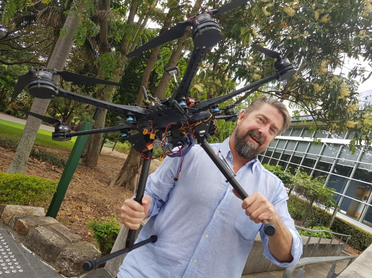
Dr. Hamilton’s research area is the protection of endangered species, and he applies the latest technology to his work. His most recent success has been leading a multidisciplinary team that uses drones carrying thermal cameras and artificial intelligence, to locate koalas in the gum tree habitat where they are very difficult to spot.© Queensland University of Technology
What makes your system so good at locating koalas?
When you or I go out in the bush and look for koalas we see about 20% of them. An expert, looking from the ground, will find about 70%. We use a high-resolution thermal camera carried by a drone, and putting that together with machine learning, have achieved even better results. We could be sure of our number because the work was carried out in an area where we have radio-collared koalas, so we knew exactly how many were in that area.
We were surprised at how effective it was, because the environment is complex. Others have used drones in open environments, such as looking for seals on beaches or wildebeest on plains, but koalas live in gum trees that are more irregular, and it’s hard to detect species in the canopy.
Drones have been around for a while, why is your new work more successful?
With drones you get a perspective you couldn’t previously get. I was involved in a previous project about drones, where the focus was more on learning how to fly, rather than the ecological context.
As a quantitative ecologist, I knew the essential elements we needed to develop a robust methodology, for example, finding out probabilities of detection by running comparisons with ground-based observers.
The artificial intelligence is exciting, and it’s a tool that will be increasingly useful. When dealing with threatened species it takes scientific knowledge to apply it sensibly in the right context.
What are the challenges in using artificial intelligence to look for wildlife?
If you want to train an AI to look for koalas, you need a database to start telling the machine this is what a koala looks like. But there aren’t existing databases of most threatened species, for example, if you want to look for thermal images of koalas, there aren’t that many images to train AI available on the web. The issue in conservation generally is dealing with things that are scarce. The more critically endangered they are, the fewer images, so it’s harder to create these algorithms.
I teamed up with Dr Simon Denman and he came up with a combination of two deep convolutional neural networks that meant we could use far fewer images than would typically be necessary.
How will koalas benefit from the new technique?
In some parts of Australia, koalas are in precipitous decline. In southeast Queensland the numbers have declined by 80% in the last 25 years, mostly because of habitat loss. When humans move in, dogs come too, and they will attack koalas. There are also car strikes, especially at the time of year where male koalas come down from the trees and go looking for a mate. There are also diseases, including chlamydia.
Accurate monitoring methodology is crucial for conservation. Without knowing how many there are, you can’t manage them properly.
Everyone loves conservation, but it seems that no one wants to pay more for it, so we need more efficient ways to monitor and manage threatened species. Human monitoring brings substantial errors, and is time-consuming and expensive. Now we’ve developed a methodology that covers 40 hectares and captures thermal imagery in a couple of hours, and only takes two hours to process.
Our purpose is to push this out to other people looking for koalas. In the next few years we hope to start getting more data, monitoring for abundance and seeing trends in different areas. If you can do it accurately and cheaply you can monitor much greater areas.
But drones won’t fix the problem alone. They sit alongside humans. There are some places drones can’t go, other places humans can’t go.
How easy is it to transfer this technology?
We applied this koala data from another site in southern Australia, so we know it works with data that’s been captured by someone else.
We want to use the methodology to monitor other species. It could be critically endangered wombats, or species in other countries. It could also be with invasive species, which cause enormous problems. Right now we’re testing it on feral deer. It doesn’t even have to be with thermal imaging.
How has the environment at QUT helped make this project a success?
I have access to people with the latest expertise, such as Simon Denman, whose office is only 50 metres away. We chat and our ideas evolve together. I’m working with cutting-edge technology and leading analytics. Fusing those is really exciting.


