
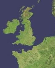
 A ridge of chalk once bridged the Dover Strait.NASA
The island that is now England, Scotland and Wales was severed from continental Europe by a cataclysmic flood during the last ice age, according to a group of researchers based in Britain.
The team, led by Sanjeev Gupta, a geologist at Imperial College London, have found strong evidence at the bottom of the English Channel for a 'super-flood' theory first suggested more than 20 years ago1. At that time, the idea that the Dover Strait — the narrow seaway that separates England and France — was created by a massive surge was widely ignored because of lack of solid geological evidence. That has now changed.
Gupta and his team first came across the old speculations by chance. They were fascinated by the idea, and realised that today's technology would allow them to look for geological traces of megafloods at the seafloor.
Gupta and his colleagues used data from the UK Hydrographic Office, collected for the purpose of ensuring safe navigation, to map the sea floor with this idea in mind. More recent data was collected by ships equipped with GPS and high-resolution acoustic measurement devices.
Their survey reveals several distinctive features typical of large-scale flood flows, the team reports in Nature today2. The straight shape of the wide underwater valley, a floor grooved and gouged as if by flowing water and tumbling rock, and streamlined 'islands' of raised sea-floor between deeper channels all bear striking resemblance to landforms sculpted some 15,000 years ago by the Lake Missoula flood in the northwestern United States. Similar landforms on Mars are also thought to have been formed by large floods.
Such floods are extremely rare, and although their energy is huge, geological records of their impact are subtle. "We couldn't have identified it [as a flood] without these analogies," says Gupta.
Over the top
“It will be very difficult to counter the evidence.”
Philip Gibbard, Cambridge University, UK
Hundreds of thousands of years ago, a ridge of chalk rock stretched from England to France, roughly between Dover and Calais. To the northeast of this ridge, melting ice and rivers fed a huge glacial lake, blocked in the north by a wall of ice, which was the primeval start of today's North Sea. To the southwest, Britain was connected to Europe by low-lying land.
At some point, the rising waters of the North Sea lake must have over-topped the ridge, creating a massive waterfall down to the southwest. A first flood probably occurred around 425,000 years ago, the team proposes, as other evidence points to the existence of a North Sea lake at that time.
The flow must have quickly become torrential, with perhaps as much as a million cubic metres of water per second being discharged over the cliff face and gouging out the Dover Strait.
"I had previously thought the overspill would have been much more organized, more like a river than a deluge," says Philip Gibbard, a quaternary geologist at Cambridge University, UK. "But the assemblage of new observations is fully convincing. It will be very difficult to counter the evidence."
Birth of an island
A second spill is likely to have occurred some 200,000 years later, during the most recent ice age, when again ice would have blocked up the north and created a lake where today's North Sea lies. This flood was probably even more powerful than the first one, enlarging the Dover Strait to almost its present size. From then on, Britain would have been an island, only intermittently connected to the continent during times of extremely low sea level.
"They make a really strong case," says Victor Baker, a hydrologist at the University of Arizona in Tucson, adding that the complex issue of timing the events is the main caveat of the otherwise convincing study.
ADVERTISEMENT
Gupta says theirs was only a "first-hand study", with a lot of additional work, on precise timing, location and discharge rates of the floods, still to be done. The impact of the deluge on early human colonization of Britain, and on ocean currents in the Atlantic, is also unclear.
Dangerous floods are commonly associated with glaciation. But the surge of the English Channel was massively larger in size and impact than floods that occur fairly frequently in places such as the Himalayas today. "This was perhaps the biggest flood on Earth we have evidence for," says Gibbard.
Visit our megafloodthatmadebritai.html">newsblog to read and post comments about this story.
