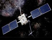
 GPS satellites can precisely monitor the behaviour of tectonic plates.NASA
Global positioning systems (GPS) could help identify the places most at risk of devastating earthquakes, say researchers who have used the technology to identify high-hazard 'locked zones' that can spawn giant quakes.
GPS has been used already to reveal the location of a locked zone to the west of Seattle, suggesting that the epicentre of a future quake could be closer to the city than experts had previously predicted.
Locked zones occur where adjacent tectonic plates appear 'locked' together as a result of the friction between them. When the plates eventually overcome the friction and break free, the release can cause devastating earthquakes as the earth´s surface lifts or falls.
Reports on the precise GPS measurements were unveiled by researchers attending a meeting in Acapulco, Mexico, held by the American Geophysical Society and several Latin American geophysical associations.
Urban risk
The new data chart the locations of several locked zones from the US Pacific Northwest to southern Mexico. In the case of Seattle, the locked zone is about 60 kilometres closer to the urban area than was previously thought, says geophysicist Tim Milbourne of Central Washington University in Ellensburg. Previous measurements of strain generated where the Juan de Fuca plate grinds into the continental plate at the edge of the Pacific Ocean had suggested that the locked zone was by the coast and therefore further from Seattle itself.
Because the worst damage occurs when an earthquake's epicentre is right under a metropolitan area, Milbourne and his team are now working to confirm the locked zone's location. In 2001, a 6.8-magnitude earthquake about 60 kilometres southwest of Seattle caused more than $500 million in damage. Estimates of what would have happened had the quake been right under downtown Seattle put the damage figure at around $8 billion.
Meanwhile, in the Mexican state of Guerrero, a collaboration of US and Mexican scientists has charted another locked zone — named the 'Guerrero gap' where there has been no earthquake for nearly 100 years — that runs for 200 kilometres along the coast near Acapulco.
This critical zone is about 400 kilometres south of Mexico City, home to more than 19 million people, says Vladimir Kostoglodov, a physicist at the National Autonomous University of Mexico in the city. In 1981, an earthquake triggered by the clash of the Cocos Plate into the North American Plate off the coast of southern Mexico killed 10,000 people in the Mexican capital.
Because the city is built on water-saturated land, seismic waves from a major Guerrero quake "would be catastrophic", says Kostoglodov's colleague Kristine Larson of the University of Colorado at Boulder.
Disaster avoidance
ADVERTISEMENT
Potential catastrophes are why researchers are hoping that GPS can help them map locked zones more effectively. GPS networks send altitude and location readings to satellites that can thus chart movements on the earth's surface with an accuracy of a few millimetres. This allows them to monitor 'slow-slip events' to define locked zones.
As more GPS are installed and produce measurements, the researchers hope to be able to regularly locate zones of higher risk.
Visit our couldofferbetterfault_l.html">newsblog to read and post comments about this story.
